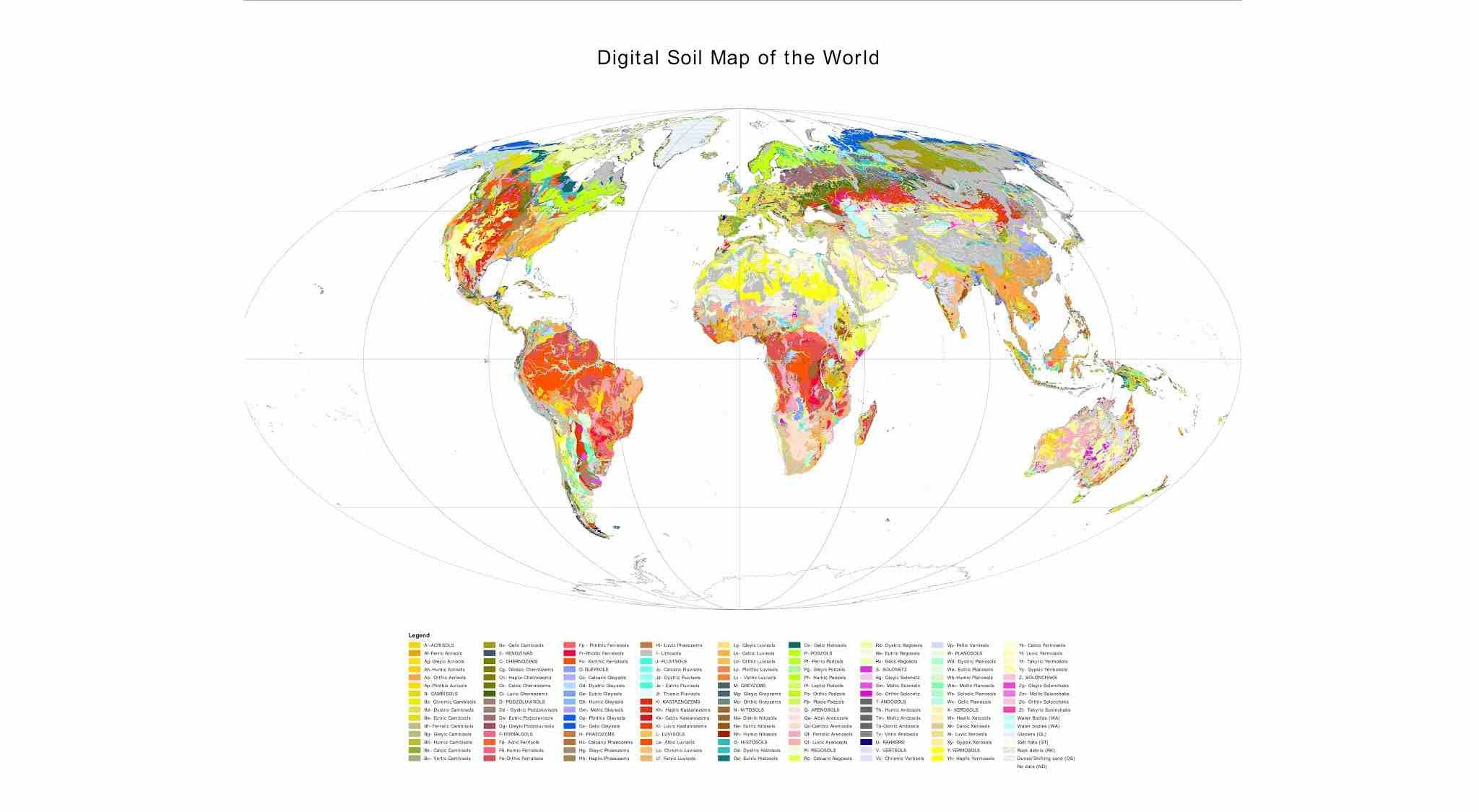
Download Shapefile Jenis Tanah Seluruh Dunia Lengkap (Skala 1 : 3.000.000), Sumber FAO-Unesco th 2007
| Title | Digital Soil Map of the World |
|---|---|
| Date | 2007-02-28 |
| Date type | Revision: Date identifies when the resource was examined or re-examined and improved or amended |
| Edition | version 3.6 |
| Presentation form | Digital map: Map represented in raster or vector form |
| Abstract | The vector data set is based on the FAO-UNESCO Soil Map of the World. The Digitized Soil Map of the World, at 1:5.000.000 scale, is in the Geographic projection (Latitude - Longitude) intersected with a template containing water related features (coastlines, lakes, glaciers and double-lined rivers). The Digital Soil Map of the World (except for the continent of Africa) was intersected with the Country Boundaries map from the World Data Bank II (with country boundaries updated to January 1994 at 1:3 000 000 scale), obtained from the US Government. For Africa, the country boundaries are derived from the FAO Country Boundaries on the original FAO/UNESCO Soil Map of the World. Country boundaries in both cases were checked and adjusted in certain places on the basis of FAO and UN conventions. The maps (jpg and pdf) are also available on the FAO soil Portal together with their reports for the following regions : North America, Mexico and Central America, South America, Europe, Asia, South Asia, Nortah and Central Asia, Sourtheast Asia and Australasia. [http://www.fao.org/soils-portal/soil-survey/soil-maps |
| Purpose | Harmonized soil information. |
| Status | Completed: Production of the data has been completed |
| Maintenance and update | As needed: Data is updated as deemed necessary |
|---|---|
| Descriptive keywords | soil , dominant soil , Terrastat , DSMW (theme). |
| Descriptive keywords | World (place). |
| Access constraints | Copyright: Exclusive right to the publication, production, or sale of the rights to a literary, dramatic, musical, or artistic work, or to the use of a commercial print or label, granted by law for a specified period of time to an author, composer, artist, distributor |
| Use constraints | Copyright: Exclusive right to the publication, production, or sale of the rights to a literary, dramatic, musical, or artistic work, or to the use of a commercial print or label, granted by law for a specified period of time to an author, composer, artist, distributor |
| Spatial representation type | Vector: Vector data is used to represent geographic data |
| Language | English |
| Character set | UTF8: 8-bit variable size UCS Transfer Format, based on ISO/IEC 10646 |
| Topic category code | Geoscientific information |

